
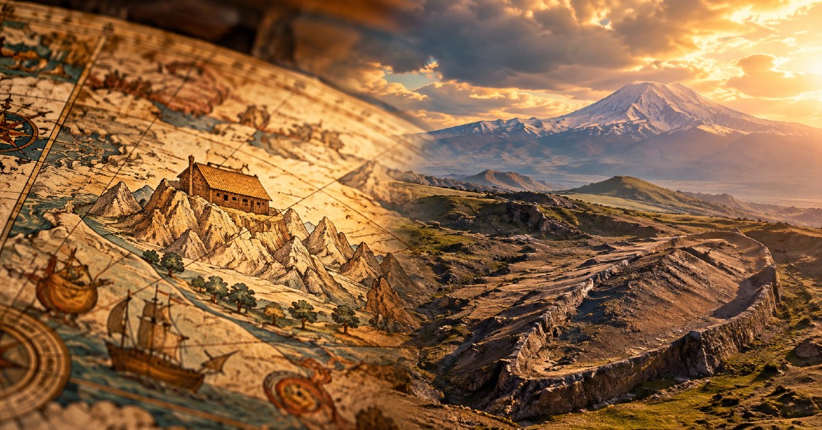
A remarkable map drawn more than four centuries ago is drawing new attention to the search for Noah’s Ark — because it places the biblical vessel in the same region where researchers today are investigating a mysterious boat-shaped formation.
The enormous world map was created in 1587 by Italian nobleman and cartographer Urbano Monte. Among its extraordinary illustrations is a depiction of Noah’s Ark resting on the mountains of Ararat, according to the Daily Mail.
Now, centuries later, researchers are examining the Durupınar Formation in eastern Turkey, roughly 18 miles south of Mount Ararat, amid renewed claims that something unusual may lie beneath the ground.
The connection has captured the attention of those following the search.
Independent researcher Jimmy Corsetti pointed to the apparent similarity online, writing, “The same location as the Durupınar site, virtually the exact same length. Coincidence?” according to the Daily Mail.
Monte’s map itself is no modern creation. Stanford University describes his 1587 world map as one of only three surviving manuscript copies and says the extraordinary work was assembled from 60 individual maps. Monte created it after witnessing the Japanese Tenshō embassy visit Milan in the 1580s, drawing on the geographic knowledge, travel accounts and histories available during the Renaissance.
The original map was designed to form an enormous circular image of the world more than 10 feet across, according to Stanford, and is elaborately decorated with animals, rulers, sea creatures and other illustrations.
For Christians, however, one tiny detail is particularly striking today: Monte placed Noah’s Ark on the mountains of Ararat.
That location echoes the biblical account in Genesis.
After the waters of the Flood began to recede, Scripture says, “the ark came to rest on the mountains of Ararat” (Genesis 8:4).
The centuries-old illustration does not prove that Monte possessed special knowledge about the Ark’s location. The association between Noah’s Ark and the mountains of Ararat is ancient and comes directly from Scripture. But the map has resurfaced at an extraordinary moment, as investigators studying the nearby Durupınar Formation report new findings they believe challenge the explanation that the site is simply a solid natural rock formation.
According to the Daily Mail, the team behind Noah’s Ark Scans says recent radar work detected multiple layers beneath the surface and patterns researchers have interpreted as possible chambers, corridors and tunnels.
“For decades, skeptics have had one simple answer for the boat-shaped Durupınar Formation: it is just a solid lump of natural rock,” Noah’s Ark Scans said, according to the Daily Mail.
Andrew Jones, founder of Noah’s Ark Scans, said preliminary radar findings do not reveal “a simple homogeneous solid-rock signature,” according to the report.
Researchers have also recovered samples from depths approaching 60 feet.
“We have so far recovered layers of rich organic material that we believe could be the decayed top-tier remains of the Ark,” Jones said, according to the Daily Mail.
Other reported findings have added to the intrigue.
The research team says radar scans have detected unusual internal patterns, including right-angle features beneath the surface. Tests have also reportedly found elevated carbon levels in material collected from inside the formation compared with surrounding soil.
Lead archaeologist Dr. Cenker Atila said the difference was substantial.
“The amount of carbon coming from the interior of the ship is 40 percent higher than what was found outside,” Atila said, according to the Daily Mail. “This raises the idea that there may be organic material or remains of wood.”
No actual wooden structure from Noah’s Ark has been recovered, however, and the latest findings have not independently established that the Durupınar Formation is a man-made vessel — much less the biblical Ark.
That distinction is critical.
Many scientists have historically interpreted the unusual formation as a natural geological feature, while the researchers currently studying it argue their latest data deserve further investigation. The samples collected during the project are undergoing laboratory analysis, according to the Daily Mail, with researchers expecting a more complete analysis to follow.
For Catholics, archaeological discoveries are not required to establish the theological meaning of the Flood account. The Catechism points to Noah and the covenant following the Flood within salvation history, describing the covenant with Noah as an expression of God’s relationship with humanity after the Flood.
Still, the possibility of finding archaeological evidence connected with biblical history has fascinated Christians for generations.
And that makes the resurfacing of Monte’s extraordinary map especially compelling.
More than 400 years before ground-penetrating radar, carbon measurements and modern archaeological surveys began probing the soil around Durupınar, a Renaissance cartographer drew Noah’s Ark resting among the mountains of Ararat.
Today, researchers are digging into that same ancient region.
Whether what lies beneath the Turkish soil has anything to do with Noah’s Ark remains unproven.
But with centuries-old history, Scripture and a mysterious boat-shaped formation suddenly converging once again on the mountains of Ararat, the search for one of the Bible’s most famous vessels is far from over.
Your support brings the truth to the world.
Catholic Online News exists because of donors like you. We are 100% funded by people who believe the world deserves real, uncensored news rooted in faith and truth — not corporate agendas. Your gift ensures millions can continue to access the news they can trust — stories that defend life, faith, family, and freedom.
When truth is silenced, your support speaks louder.